Tuesday, 17 July 2012

Walk 10 - Lathkill Dale Circular Walk. Approx 9 miles


Lathikill Dale is one of our countries finest limestone valleys.  It's steep sides hide the crystal clear streams that carve there way through this wonderful place.  


We start our 10th walk in the Derbyshire village of Monyash which lies a couple of miles outside the pudding town of Bakewell.  This is a very popular walk with us and we complete it many times throughout the year in all seasons as its quite close to home.  On this occasion we decided at the last minute to walk it the opposite way to what we normally do so please bear in mind you can walk this in reverse if it takes your fancy.


Just on the outskirts of Monyash is a small car park which has public toilets, I do believe the car park is designated disabled only but there is ample roadside parking.  It does get quite busy so I would recommend an early start.


Start/Finish

Go through the gate across the road by the red Dog Poo bin, this is the entrance to Lathkill Dale, it may not look so inviting to start with but believe me it soon closes up into a steep sided valley.

As you go through the gate the obvious path heads for the Dale, continue along the path.

Milly heading towards the dale

Continue through the field to the next gate, this is where the Dale starts to show its true colours.  Due to some heavy quarrying many, many years ago the bottom of the Dale is littered with quarry spoil, large rocks that were abandoned by the quarrymen.  This can be a bit of a scramble and when its wet, can be very slippery so take care.  The photo below shows where the quarrymen tipped the spoil into the Dale. it was taken from the bottom of the Dale looking up the left hand side.

Quarry Spoil left by the Quarrymen

The path is obvious, it has been trodden thousands of times by leisure walkers from as far back as Victorian times and before then by the many lead miners that worked in the dale.  The sides of the valley steepen significantly so there is not that much to see for about a quarter of a mile.

The Valley opens up again and you are now able to take in the beauty of the dale:

Leaving the Quarry behind

Here the Dale opens and to the right (just make out the fence) is the home of a colony (I think thats what you would call it) of a plant called Jacobs Ladder.  Apparently this plant is extremely rare in the wild but here, is one of the countries largest colonies.  We did this walk toward the end of June so as the plant flowers May and Jun we were lucky enough to see it in bloom.  I am not into flora and forna but I have to admit it was a very impressive display.  In all the years we have been walking Lathkill Dale this was the first time I had seen the colony in full bloom:

Jacobs Ladder

Why is it called Jacobs Ladder?  Well there is an information sign so when you visit and do this walk you will be able to learn all about it :-)

After you pass the colony of Jacobs Ladder the path becomes a little better underfoot and before long you will see the river emerging from underground through the mouth of a cave just to your right.  In the dry summer months (if there is such a thing anymore) you can actually step inside the cave and if you are quiet you can hear water running deep under ground.  

River coming up from the depths

As we all know its not exactly been a dry summer so the river was as high as I have ever seen it so we had to take a few detours from the path as normally it weaves close to the river but on this occasion the path was well submerged.

There is a bright side to all this water though and its about a half mile further on!

As you leave the cave Lathkill Dale sweeps right, continue to follow the path or in this instance the river.  You will see to your left a another dale sweeping in, this is called Cave Dale, we are yet to explore this, maybe next time.

Continue along the path, walking past the wooden bridge on your right and you soon arrive at the Lathkill Dale waterfall.  This is the perfect place to stop and have a coffee.  It has a nice peacefulness about it but it is a popular resting place and picnic spot.  I am a bit of a geek when it comes to waterfalls, I love photographing them, this is why there is a bright side to all this wet weather :-)

Lathkill Dale waterfall

Come on, you have to admit this is a lovely spot!  Lush green trees, soft, gentle crystal clear water.  Is there any wonder I love where we live!

So, after the well earned coffee, continue along following the river.  After the waterfall the Dale becomes shrouded in woodland, the path widens and the walk become easy underfoot.

Continue along the Dale for a about 3 miles taking in the peacefulness of the place.

 Diane following Milly and me along the river

As you walk along the Dale if you keep your eyes peeled you will notice many remnants from the old lead mining industry, its mostly on the opposite bank, you can see the ruins of the old mining buildings.

Eventually you will reach a small village with just one or two houses that sit on the river bank.  Here you turn right and cross the stone bridge over the river.

Just filled up my Travel Tap in the river before crossing the bridge


When you cross the bridge you enter woodland and start to climb out of the Dale, its not a very steep path, but you are glad to reach the top if you know what I mean!

When you reach the top you enter a field through the gate, follow the signpost and turn immediately left heading for the farm.  The path takes you directly through the centre of the farm yard and through a gate on the opposite side.  It is very muddy here at the best of times and as its a thoroughfare for the farms cattle, well, its not always mud if you know what I mean!

Diane and Milly exiting the farm

As you exit the farm the path becomes a little difficult to make out.  Just follow the high wall to your right until you come to a broken signpost:


The sign should actually say Footpath To Youlegrave, this is the direction you need to walk.  The path crosses meadows on we were lucky enough to have the meadows in flower when we walked through, really beautiful.  This is a good opportunity to stop and have a good look around you, the Derbyshire countryside really opens up in front of you and on a clear, sunny day the views are spectacular.

Follow the footpath through the meadows until you come to a stile which puts you onto a road.  This is the only bit of road walking to do before you get back to Monyash.  I am not a fan of walking on roads, they are mostly enclosed by walls or hedgerows and you dont get to see anything.  Once over the stile turn right and head up the road for about 500mtrs.  When you get to the top there is Moor Lane to your left and to your right you enter a field picking up the Limestone Way heading for Low Moor Wood.

Diane and Milly picking up path of the Limestone Way

Follow the path that takes you into Low Moor wood.  its not a very big wood but when the blue bells are out this is the place to bring your camera.  I have never been able to catch the Blue Bells here but I have heard the whole wood is filled with their scent.

As you walk through Low Moor wood you skirt a farm yard to your left and the path starts to take you down hill towards Cales Dale.  As you head down the path you get a good view to your right of Lathkill Dale.  Continue to follow the signs for the Limestone Way.

 Looking right towards Lathkill Dale and Cave Dale

Continue through the fields until you get to a Kissing Gate.  This is the top of Jacobs Ladder!  No not the flower as above but a steep climb down into Cales Dale.  Too many Jacobs Ladders in Derbyshire, it gets confusing!

Head down the steep steps into the bottom of Cales Dale and at the bottom you are presented with a few paths that you can follow.  For this particular walk you want to pick up the signs for One Ash Grange:


That means that you go up the other side of Cales Dale so there is a bit of a climb as Milly quite happily demonstrates:

Milly thinking she is a Nepalese Sherpa!

Climb up the path and when you reach the top One Ash Grange Farm comes into view.  This is a good place to stop and have a brew before entering the farm.  

Me having a well earned coffee

Cross the field following the path to One Ash Grange farm and climb the steps into the farm yard.  Follow the track around the farm house then turn right up the lane heading away from the farm and back towards Monyash.

Continue up the lane and pass the horse jumping field on your left, as you get to the top of the lane the lane goes to the right but leave the lane and head left keeping the hedgerow to your left.  Miss this turn and you will find yourself heading back to Lathkill Dale.

Continue up the field to the gate, go through the gate and turn right along the edge of the field following the Limestone Way.

You eventually arrive at a gate with the following view over Fern Dale:


Here you turn left onto Milkings Lane (no sign to tell you its Milkings Lane), although its hard to see why its a lane, this does become more obvious as you follow the track.  The lane becomes wider and has walls on either side, keep on this lane and it takes you back into the village of Monyash.


As you leave Milkings Lane you pick up the road that heads back into Monyash. keep on the road and head towards the houses ahead.  Continue along the road as it sweeps right around the village pond to the cross roads which is the centre of the village.  Opposite you will see the Bull's Head Pub and the Smithy Cafe, we always stop at Smithy's for lunch, they do a cracking beef and stilton sandwich!.  If you are not bothered about lunch turn right at the crossroads and walk along the road heading back towards Bakewell.  Pass the Campsite on your left and in a short while you will return to the start of the walk and back to your car.

This really is a pleasant walk that really shows what Derbyshire is all about.  We have done this walk more times than I can remember and no doubt we will do it many more times.

Please feel free to leave any comments or questions about the walk.

Our next walk is from Snowdonia after we revisit Larry's cottage, our first visit since he passed away, hopefully the weather will hold out for us, but I wont hold my breath!


Saturday, 23 June 2012

Walk 9 - Buckden Pike incl War Memorial. Approx 7 miles


Buckden Pike sits high above the village of Buckden in the beautiful Yorkshire Dales.  We did this walk last year whilst on holiday and promised to come back and do it again hence this blog. Buckden sits in Wharfedale between Kettlewell to the south and Hubberholme to the north.


This is the first walk on our adventure that we have had to do without Milly, our chocolate lab.   She injured her leg whilst swimming so we are having to rest her for a few weeks.  She will soon be back, don't worry.


This walk is very steep in places and can be very hard work so a decent level of fitness is recommended otherwise it may not be as enjoyable as it could be, it also involves a bit of scrambling down rocks as well.


The start point is in the car park in Buckden, as with most car parks in the Yorkshire Dales, be prepared to dig deep into your pockets as the cost of parking over 2 hours is very expensive - £4.20.


As you stand in the car park facing the village look right to pick out the path.


Go through the gate and follow the path as it rises steadily up the hill.  Its a gentle climb that goes around to the right as you get through the trees. As you come out of the trees, look back towards the car park for a terrific view of Wharfedale.


The terrain, for a short while anyway seems to flatten out a bit, dont be fooled though as the climb starts again very quickly.  

As you approach the top of the track you come to a gate, the track then turns into a path that sweeps to the right, it is signposted so it is easy to pick up, you start to head across the face of the hill to the right.  The path is well trodden so not too difficult to follow, it does get a bit boggy in places and can be hard work but its worth it just for the views across to Cray and Hummerholme (looking to your left).  

Its now you start to climb albeit quite gentle to start but believe me it does get harder.  Before the going got tough I thought it time to top up with water:


Obviously drinking water straight from a stream isn't recommended but as my bag gets pretty heavy with all my camera kit and Diane's waterproofs, the thought of carrying litres of water with me doesn't appeal.  A couple of years ago I invested in a water bottle called the Travel Tap to take to Malaysia with us , it looks just like a normal plastic water bottle but it has a built in filtration system that allows you use any source of water apart from salt water.  

I have used it many times from all sorts of water sources including rivers, cattle troughs, muddy puddles, all sorts and I have never been taken ill.  They are widely used by the Red Cross.  If you are fed up with carrying drinking water water everywhere, get yourself one of these

As you can see from the photo above the path continues gently up and across the face of the hill.  The path actually heads for a drystone wall in the far distance.  Its when you reach this wall the fun starts!

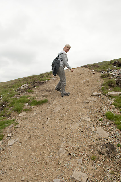
When you reach the wall the path goes right, and its straight up and its steep:


Take a look at the photo above, to get a feel for how steep this path is look at the angle of Diane's right foot as it sits flat on the ground.  This stretch of the walk is lung busting but the upside is it only goes on for about 7-800 metres.

There is one point where you actually think "when I get over that hill I'm there thank God".  Hmm thats not strictly true, its one of those climbs where you get to the top of one rise, only to be faced by another.  


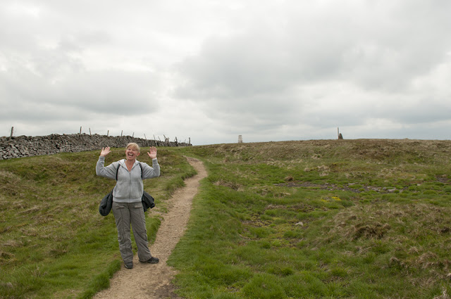
You know when you are at the top when you see the Trig Point and the Cairn:


You can see the delight on Diane's face as she finally reaches the top.

When you reach the top have your coffee sat by the Cairn which is the sticking up bit to Diane's far left, the pole attached to the Cairn is for winter walkers.  The top of Buckden Pike in winter is normally under a very thick blanket of snow and the tip of the pole that pokes through the snow lets you know you have made it to the top.

I would normally show photos of the view from up hear but I think it's worth encouraging you to walk up here to see for yourself.  Trust me, its amazing. Oh go on then!


Whilst up here don't be surprised to see the odd RAF Jet skimming through the Dales below, yes you read right, below.  RAF jets on training exercises are often seen here, we have seen them ourselves, its weird looking down onto the jets as they fly past and its very noisy!

After your well earned rest at the top its time to move on.  We always walk across the top of Buckden Pike to the Polish War Memorial thats dedicated to the crew of a Polish aircraft that crashed on the top during the second world war.  The memorial is about 3/4 of a mile along the top so just have a walk over there to pay your respects.

Opposite the Trig point there is a stile over the wall (can just be made out in the photo above where Diane reaches the top) the stile was the way to go to get to the Memorial but the last time we did it we had to turn back because the peat bog was so bad and impassible.  There is now a new path with signs that recommend you dont go over the stile to get to the memorial, please take heed of the signs as it seemed worse this time we went.  

So, dont go over the stile, instead with the trig point behind you turn right and walk alongside the drystone wall:


As I said above the Memorial is just 3/4 of a mile along the top so after the climb, this bit is a doddle.

You cross over the first stile and carry on along the wall until you get to a second stile which goes over the wall you have walked along, the Memorial is just over the other side:


The concrete plinth the memorial sits on encases some of the remains of the aircraft which crashed here all those years ago, some bits just sit loosely by the side.  It looks like the Memorial gets many visitors which is a good thing.  We owe a lot to these young men who gave their lives for ours and their countrymen's freedom.

Now its time to get back on track.  Go back over the stile and head back towards the top of Buckden Pike.  Walk along the wall this time keeping to your right.  As you get closer to the Cairn you come to the next stile. Dont go over it but turn left along the wall and pick up a very faintly trodden path that sweeps to the left away from the wall.  The decent now starts.


The path is there but it is difficult to spot in places as not many walkers come this way.  As you get lower, the path becomes more prominent and it heads for a gully to your left.  Its here you get your first sight of Buckden:


You can just make out Buckden in the valley below and if you look closely you can see the path to follow.  At the bottom of the photo near the right corner pick up the line of lighter grass the goes across to the left, this is the path you need to follow.

As you enter the gully the path becomes much more obvious and much more difficult.  The path skirts along the top of the gully and it has a very steep side so care should be taken:


This is the view looking back up towards Buckden Pike, you can see here how narrow the path is, the drop doesn't look too bad here but believe me, if you fell where the rocks are you would be pushing up daisy's thats for sure.

This path takes you right into the top of the gully, here you can't miss the ruins of an old lead mine, the entrance to the mine is actually still there but we chose not to investigate, this was our spot to take on some water and a snack.  Its a nice spot and very sheltered:


Ruins of a mine that was probably in full production two hundred years ago


The entrance to the old mine

The next and final phase of the walk is down the gully, heading back to Buckden.  This phase is by far one of the most picturesque walks we have ever done.  This time the weather wasn't very kind to us so it wasn't as gorgeous as we have seen it in the past but still breathtaking.  The path downwards goes past the front of the ruins (above) and follows the beck all the way down.  At the start the flow of water is pretty mellow but the further down you go, the more inlets feed the beck therefore you come across some pretty amazing waterfalls.

The path continually swaps from one side of the beck to the other, therefore be prepared to jump and scramble across if you find the path coming to a dead end so to speak.  Eventually, as the beck grows bigger so does the path and it soon becomes obvious where you need to be.

Here are a couple of photos of a small selection of waterfalls you will see on your way down:


There are many on the way down and on a nice sunny day you will be spoiled for choice when it comes to choosing a picnic spot.  This is such a beautiful gully and its totally unspoilt.  Obviously the nearer you get to Buckden the more evidence you will see of people but by-enlarge you feel like you were the person to discover this place 

You follow the beck down into Buckden, as you reach the outskirts of the village the path becomes well trodden and you see the odd person out and about but take a final look up the beck and try to trace back your route down:


 From this point you can just make out the top of Buckden Pike in the distance.

From here, head down alongside the fence/wall that runs beside the farm. when you come to the large gate on your right go through it and immediately through another one.  This path leads you around the back of the village and conveniently brings you out at the village Bistro where the cakes and Earl Grey tea are to die for.  Dogs are not welcome inside but there is safe seating outside.

  
After the compulsory cakes and tea (yes, they are compulsory on this walk - my blog, my rules) Take a steady stroll across the road and you will see the car park where you took out a second mortgage to park your car!

My final photo was taken from the road heading back to Aysgarth, we stopped to take this picture to give you all a good idea of what Buckden Pike looks like from ground level:


This is a really good walk and probably sits quite easily in our top three walks we have ever done.

I like it so much I am prepared to drive up to the Yorkshire Dales from Chesterfield just to do this walk then drive back!  Thankfully though, we were on holiday so the drive back was only 30 mins!

I would love to read comments from other people who have done this or who are interested in doing it themselves.  As always, feel free to ask any questions you like about the walk.

Until next time..... (which will be very soon as we did a lovely walk around Lathkilldale today, I will write it up as soon as I can)

By the way, feel free to browse my website www.taptonphotography.co.uk for more photos of waterfalls in the Yorkshire Dales.  (I have a thing about photographing waterfallls!)

Sunday, 27 May 2012

Walk 8 - Dovedale Circular Via Milldale (Noah's Walk) Approx 7 Miles


Dovedale is home to the river Dove that runs through this great county of ours.  The actual walk starts at Dovedale car park which, I believe, sits just inside the Staffordshire boundary.  This is a local walk for us, just a 30 min drive from our house.

The secret to a good Dovedale walk is timing.  Yesterday (26 May 2012) we were bathed in glorious sunshine as we have been all week so the secret is to get up there early, you will see why as the blog goes on.  This is a walk we normally do in the winter, preferably on a cold, clear frosty morning.

The walk starts from Dovedale car park which is well sign posted from the main Ashbourne to Buxton road as you approach Tissington, the home of the well walked/cycled Tissington Trail.  The car park at Dovedale costs £2.50 and that's all day.  There is cheaper parking (£1.50) on the approach which is also well located for the walk, just adds on an extra half mile.

The path along Dovedale is extremely well signposted and very easy underfoot.  You start your walk by heading along the path that runs adjacent to the toilet block.  After a couple of hundred yards you have a choice, either continue along the road or cross the bridge:


We always cross the bridge, don't know why, its just something we have always done, its a bit more wobbly underfoot than the road but I think the initial view of the Dale is better from this side of the bank but its all about opinions.  If you prefer a gentle meander then take the road but you do have to cross the river at some point and the choices you have are the above bridge or the stepping stones.


After you cross the bridge turn left under the trees and Dovedale opens up, as you can see from the photograph above the path is well worn and easy to follow, basically the walk is all about following the River Dove so you are hardly going to get lost anytime soon.  The river itself looks stunning, its waters are crystal clear and on a hot day like yesterday, very tempting to throw yourself in!

Continue along the right bank of the river, the path changes depending on the level of the river water but either way its easy to follow.  It gets a little bit tasty in parts therefore I wouldn't recommend this way if you have very young children.

You will notice that the alternative road from the bridge follows the left bank, a lot more steady underfoot.

As the river corners left you come to Dovedale Stepping Stones.  This feature must have been photographed a million times.  Google Dovedale and the stepping stones will be the first images you see.


In the image above we have walked past the stepping stones and are looking back.  You can see on the right hand side where the road ends therefore you have to walk across the stepping stones to get to this side of the river to continue the walk.  The stones are incredibly stable and easy to walk across so don't worry.

You will notice I have referred to this walk as Noah's Walk.   Noah was a little tiny boy who's Mum I know.  Unfortunately little Noah didn't make it and his Mum sprinkled his ashes in this very place.  The little soul now watches over us who walk this beautiful Dale so if you do ever try this walk, tip your hat to Noah, say hello and tell him his Mummy loves him.  This truly is a special place, made even more special by little Noah being here.

We took some flowers along to make him smile and to let him know he is still in peoples thought and prayers.


We found a nice little spot to lay the flowers and we took five minutes to reflect on Noah and all the other little ones not with us.


As peaceful and quiet as Dovedale looks on these photos, rest assured it is an incredibly happy place for children of all ages as you will see later.  I am probably a little bias but the spot Noah's Mum picked is perfect for her little boy.

As you see on the photo above you can just make out the gate on the right.  For some reason this is locked most of the time why I have no idea but to the right of the gate is a stile that you can scramble over.  The gap in the stile is very narrow and poor Milly just cant fit through but she just jumps in the river beside Noah's flowers and swims around the wall.

Follow the path that winds down into the vale.


This is the view as you look back towards the stile, you can just make out the stepping stones crossing the river.  Remember this view as later in the blog I will demonstrate just how much this view changes as the day goes on!

The path does climb in places, in fact it can get a bit steep but its not a place to rush around so take your time and enjoy the view.  This trip I noticed far more trout in the river than I had on previous walks, whether that had anything to do with the gorgeous sunshine I have no idea but its worth keeping an eye on the water as you will see some trout.

There are points where the path is replaced by a boardwalk as the river runs flush up to the rock face, but they are steady enough and there are no issues using them.


If you bring kids along they are going to love this walk, as you walk down the river you come across a few caves and caverns for them to explore, the kid still hidden within me cant help but take a look.

This is one of the larger caves you will come across:


Come on, who in their right mind wouldn't want to explore that baby!

After 1.75 miles you come to a wooden bridge that crosses the river, its right beside an impressive rock called Iiam Rock  the bridge does come into play later in the walk but for now, just follow the sign for Milldale:


Now you can see why I was so precise about the 1.75 miles :-)  Milldale is the half way point of the walk but we come back a different way which adds the extra mile.

As you approach Milldale you cross a little pack bridge:


This is a lovely place to sit for a while before going across the bridge, especially on a lovely sunny day like we had.  If it's teaming down with rain, leg it quickly over the bridge to find refuge in the shelter!


As you can see, the bridge wasn't really built for modern day traffic, more for the pack horse I would suspect.  Must be a few hundred years old.  It actually has a name, its called Viators Bridge.  I have no idea why but am intrigued so if anyone does know please let me know by leaving a comment on the blog.  Even if you don't know, you can still leave comments about the walk or ask me any questions.

Milldale is a good place to recharge the batteries.  There is a small shop, actually thats not quite true, its the window of a house where a very kind and polite lady sells sandwiches and drinks and also the odd map and trinket.  The shop is easily visible as you cross the bridge just look to your right, you cant miss it.  I reckon they open everyday as I have never been and it be closed.

There is a decent shelter, (again you cant miss it) that you can take lunch should the weather be a bit rubbish, it also has a supply of fresh drinking water so you can top up your water bottle.  There are also toilets here.

As it was a nice day we decided to take our lunch on the river bank with the local ducks which kept Milly occupied, she was strictly on her lead and well and truly miserable because she wasn't allowed to chase them.

Our lunch venue:


You can see where the village gets it's name.  Obviously this was the site of a mill many, many years ago, the Millstone in the picture probably having be in the same spot for decades if not hundreds of years.

After lunch its time to head back to Dovedale car park.  Normally it's a walk back the same way you came but if you have been following my blogs, you will know I prefer my circular walks.  

You cant miss the toilets in the village, they are right where you cross the bridge.  If you take a sneaky peek to the right of the steps that leads up to the gents you will notice a sign for a footpath that indicates that after heavy rain this path becomes impassible.  A long time ago I noticed it so I got my map out, found out where it went and we have used the same route to return to the car park ever since.  

The path climbs quite steeply and is what Diane and I call a calf killer.  It is worth it though as you will discover.  (If you are a bit unsteady on your feet then I would suggest you go back over the bridge and return to the car park the same way you came.  Its still a wonderful walk back so dont feel like you have missed too much).

As the path climbs it swings left, following the line of the river but from much higher up.


As you can see above the path is a bit dubious but it is obvious and well trodden so you wont get lost.  The path continues to climb upwards through some trees then as you come out of the trees it opens up into a beautiful meadow, you could be forgiven for thinking you are in the Bavarian Alps in the summer.  Diane certainly thinks so below, here she is giving her Julie Andrews impression!


As you can see, Milly is riveted to the spot!  Such entertainment from her mum!


The path is marked by small wooden posts, just keep following them and look for the stiles.  There are a couple of stiles this way but they are easy to negotiate. 


As you continue to climb the view of the river eventually comes into view.  Continue on the path until you cross a stile that has a small barn to the right of it.  This bit is important.  As you walk across the field you will note that there is a sheep path that goes up the steep bank on the right.  This is not the footpath but I ask that you walk up it for about 75 yards, its hard work but worth it.  Plonk yourselves down and take a photograph of this view:


If you don't do the little detour up the sheep track you wont see this view.  It is truly breathtaking and no matter how many times I have photographed this, I have never captured it full beauty.  This time of the year it is priceless, in fact I would say its stunning anytime of year.


Please, please take this detour and take this photo.


OK, after getting your breath back walk back down to the track and pick up the trail again, turning right and heading back down toward the river.  Very soon you reach the river, the track is nowhere near the same quality as the track on the other bank that you used to get to Milldale but it is obvious and you can't get lost.


Continue along the path which in places gets extremely close to the rivers edge but it does give you the opportunity to take in the smell of the wild flowers if thats your thing as the bank is covered in them.  The walk down this side is really pleasant and if you are lucky you will be accompanied along the way as we were:


Milly wasn't too impressed mind as it meant her being on the lead as she would have jumped in and scattered them.  They were soon hurried along though by the flow of the river and were quickly out of sight which meant Milly could resume her water pursuits.


The path eventually ends up at the wooden bridge I mentioned early, you know, the one next to Iiams Rock?


Here you can see Diane patiently waiting for me; I was trying to capture a photograph of a bird that I had seen but I never got the shot and got nettled for my efforts.  Milly is probably in the shot but in the water I would guess.


Cross the bridge and take the trail to the right, its signposted Dovedale carpark 1 3/4 miles.  Hmmmm remember that one?


You are now back tracking along the same path you came on earlier.  Continue along the path to the car park.  If you are reading the blog and not just looking at the pretty pictures you will recall I said something about remembering an image, of how peaceful and quite Dovedale can be.


Similar shot, later in the day!


This is the approach to the stepping stones on the way back.  As you can see, on a warm day it becomes very busy with families:


The shot above was taken from where we had left flowers for Noah,  a couple of hours earlier we were the only ones in the Dale but as you can see it's a very popular picnic spot and why not!  The kids we saw were loving it, paddling in the water, fishing with hand nets and generally having a great time.  This is what I meant when I said Noah's Mum had picked a happy place.  Perfic as Del Boy Trotter would say.


At the stepping stones we decided to cross and make our way back to the car park by the road.  The road is car free so Milly was able to make the most of the river, she virtually swam it back to the car park which by now was full to bursting, with cars actually queuing to get in as opposed to our arrival earlier that morning and ours being one of only 3 cars parked up.


I really recommend this walk anytime of the year, if you do get the chance to walk it, please stop and give a couple of minutes of your time to remember Noah who rests in this beautiful place.  Something I noticed when I took the above photo off my camera.  You may not see what I see but take a look at the tree in front, about two thirds of the way up between the middle tree and the right tree I see a dark green patch in the shape of a heart.  How apt!


Thanks again for reading the blog and continuing to show an interest in our 100 mile adventure.  As always, feel free to leave comments below, ask any questions you like about this or any other walk.


We are off to the Yorkshire Dales on holiday for a week soon so I suspect the next blog will come from that area.


Thanks again.


Mark, Diane and Milly.


This walk we dedicate to little Noah